Dolina Suchej Wody (Dry Water Valley)
The area of this huge glacial valley is approx. 21 km ², and its length within the Tatras approx. 8 km. The upper branch of Dolina Suchej Wody (Dry Water Valley) – Dolina Gąsienicowa (Gasienicowa Valley) has more than 20 mountain lakes, including the biggest of them – Czarny Staw Gąsienicowy ( Gasienicowy Black Lake). In the lower and middle part of it is covered by a spruce forest, while at the top – tracts of mountain pine. The valley is made up of granite and sedimentary rocks. There are numerous formations in the area of glacial origin. In the upper part there are cirques and glacial moraines in the lower part of the valley, while the valley floor is littered with rock material carried here by the glacier. Dolina Suchej Wody (Dry Water Valley) also features as the boundary between the High Tatras and the Western Tatras (from Liliowe Pass along the Sucha Woda Brook). The name of the valley comes from the brook flowing through it; the trough – as the name suggests – is usually dry and the water flows underground.
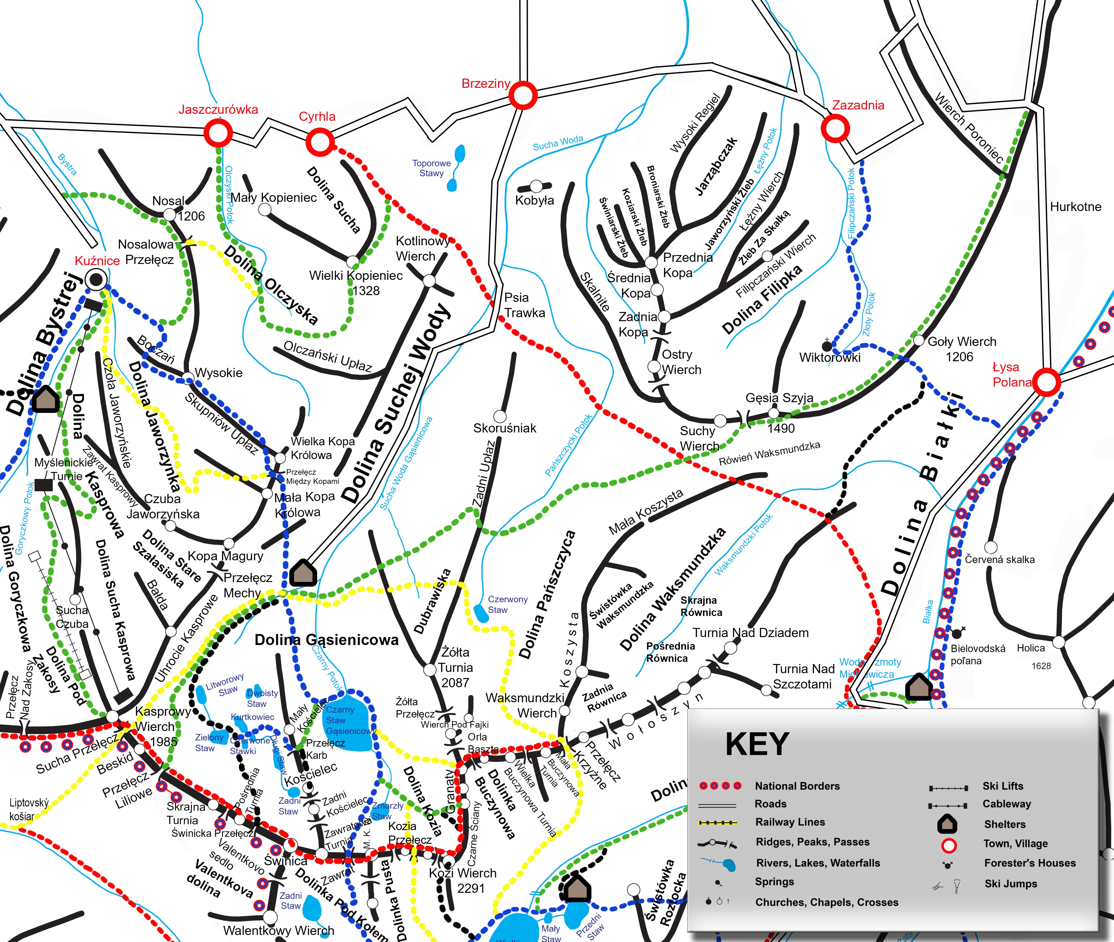
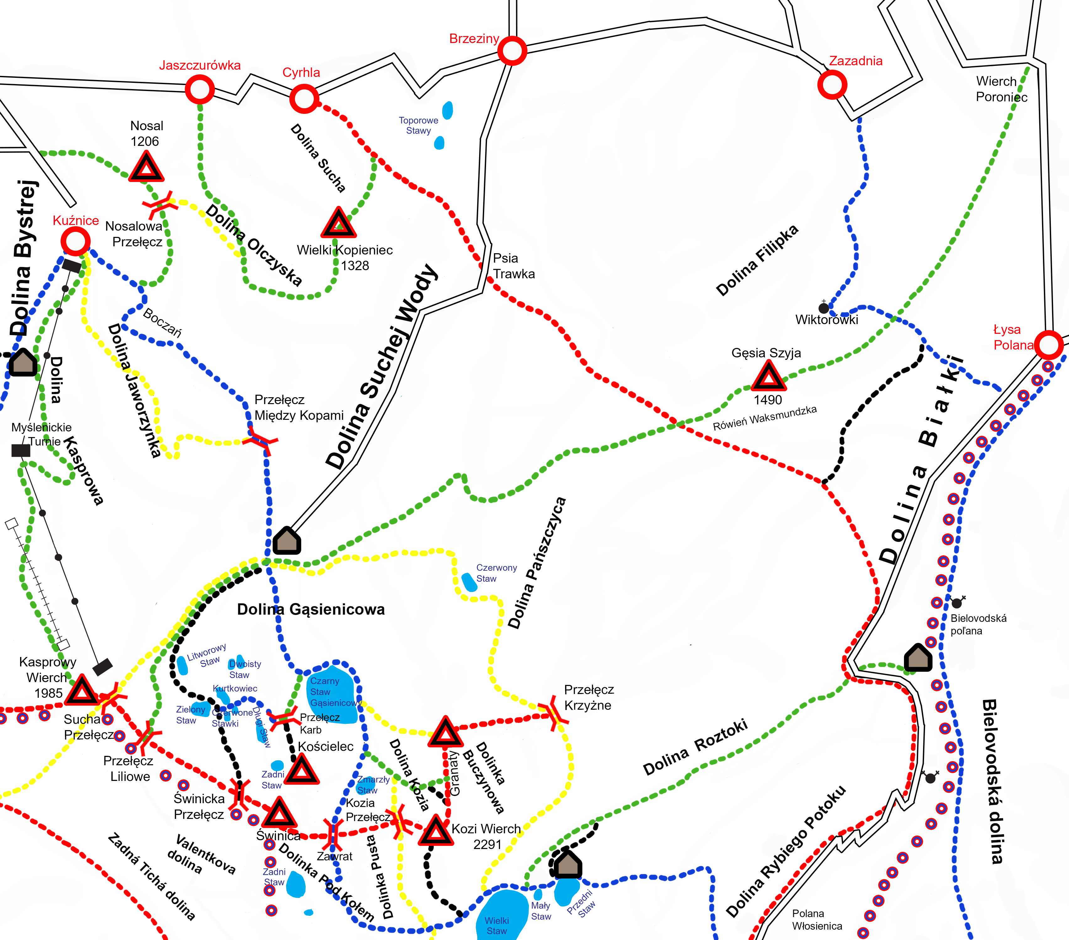
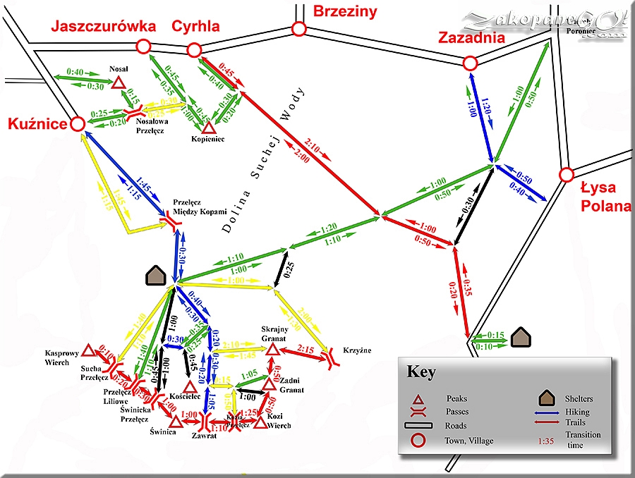
Hiking trails in Dry Water Valley
 Kuznice – Hala Gasienicowa – Zawrat Pass
  Jaszczurowka – Kopieniec – Cyrhla
  Wierch Poroniec – Hala Gasienicowa – Liliowe Pass
  Zazadnia – Rusinowa Glade
  Hala Gasienicowa – Krzyzne Pass
  Czarny Staw (Black Lake) – Granaty Peaks
  Hala Gasienicowa – Koscielec – Czarny Staw (Black Lake)
  “ORLA PERC” (“EAGLE PATH”)