Kuznice – Dolina Kondratowa (Kondratowa Valley) – Giewont
![]()
Difficulty Level: ***
Walking Time: 3h 20′ (5,8 km)
![]() 894m (2933ft)
894m (2933ft)
![]() 10m (33ft)
10m (33ft)
Climbing Features – Metal chains & brackets
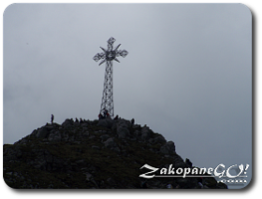
Highest Point: Giewont – 1894m (6214ft) a. s. l.
The most popular and least tiring way to Giewont. Our journey starts at the lower station of the cable car to Kasprowy Wierch. The trail is marked in blue and leads to the right, along a comfortable route lined with stones, which is at the same time is used for transporting goods to the highland hotel on Kalatowki Glade.
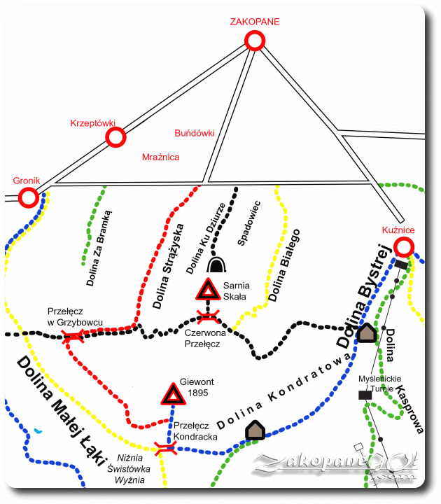
After around 10 minutes, the road peels off to the right towards the Albertine monastery, while to the left side we see the female equivalent of the monastery of that Order. At the monastery the trail splits. To bypass the shelter on Kalatowki, you need to choose the trail to the left, which gradually becomes steeper. It is worthwhile to stop off at the monastery, built in 1901, and the hermitage of St. Brother Albert who was the founder.
The room in which St. Albert stayed is almost entirely taken up by a narrow, wooden bunk. The small room next to it is now a memorial. The hermitage was visited by Pope John Paul II during his visit to Poland in June 1997. Often visited by tourists in large numbers wandering this way into the mountains.
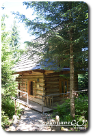
If you chose the trail which runs next to the highland hotel, we reach the edge of the clearing on which it stands within 10 minutes. Just outside the hotel, on the right side, there is a trail, marked in black, called Droga pod Reglami. The Kalatowki Glade offers a view of the Dolina Bystrej (Bystra Brook Valley) and the intermediate cable car station on Myslenickie Turnie.
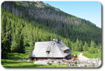
The highland hotel was built ahead of the Ski World Championships which took place in Zakopane in 1939. It has 86 beds of a high standard, with 1, 2 and 5-bed rooms and suites available all year round.
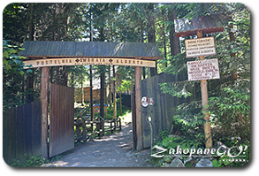
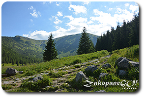
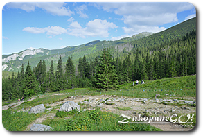
Going further, we head down a bit and enter the forest, along a comfortable, rocky footpath. After about 35 minutes we reach the vast Polana Kondratowa (Kondratowa Glade), on which the smallest shelter in the Polish Tatras stands at an altitude of 1335m a.s.l. From the shelter there is a choice of two different pathways, blue signs lead further towards Giewont, and a green trail towards the Przełecz Pod Kopą Kondracką (Under Kopa Kondracka Pass). On April 26th in 1953, the shelter was damaged by a rock avalanche that came down from the slopes of the Long Giewont. A boulder weighing 30 tonnes crashed into the corner of the dining room, and another one twice the size rolled to a halt barely a few meters away. You can see it right next to the walls of the shelter. From Hala Kondratowa we head further along the blue trail. Once again we enter the forest, which begins to fade as we ascend. The path alters also, as we begin to climb the stone steps. Przełęcz Kondracka (Kondracka Pass – 1723 m asl) can be reached within less than an hour where we intercept the yellow trail to Kopa Kondracka, or Dolina Małej Łąki (Little Meadow Valley) in the other direction.
Giewont appears on the right as we walk the narrow path among the mountain pines, then continue along the blue trail, which after a few minutes will take you to Wyżnia Przełęcz Kondracka (Upper Kondracka Pass). At this point, the red trail from Dolina Strążyska (Strazyska Valley) joins from the left and we continue the journey as described in the previous section.