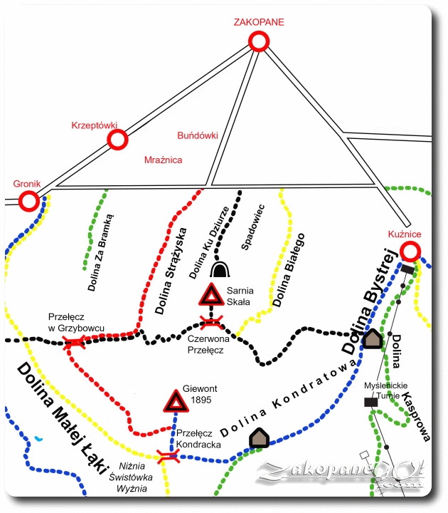
Kalatowki – Sarnia Skala – Dolina Strążyska (Strazyska Valley)
![]()
Difficulty Level: *
Walking Time: 2h 30′ (4,5 km)
![]() 334m (1096ft)
334m (1096ft)
![]() 490m (1608ft)
490m (1608ft)
Climbing Features – NO
Highest Point: Sarnia Skala – 1377m (4518ft) a. s. l.
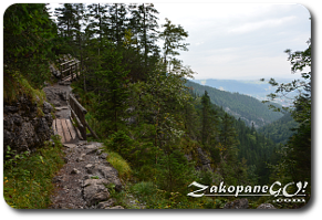
The trail called “Ścieżka Nad Reglami”, marked in black, originates at the lower edge of the Kalatowki Glade. We head off the stone road, through a thick forest and up the steep slopes of Krokiew massif. It’s a slightly tiring, half-hour approach which ends at Przełęcz Białego (Bialego Pass) where you can see Dolina Bystrej (Bystra Brook Valley), Kasprowy Wierch and the eastern part of Giewont.
Next, we gently descend over impressive wooden bridges suspended over steep gullies, passing by the specific rocks called “Zameczki”. Soon we reach the Bialego Glade, which is almost completely forested. Our path joins the yellow trail running from the Dolina Białego (White Creek Valley heading to Zakopane which, if necessary, allows us to shorten the route. The trail then climbs sharply up at Czerwona Przełecz (Red Pass), from which we can reach Sarnia Skala (Roe-deer Rock).
 Long Giewont Hillside
 “Zameczki”
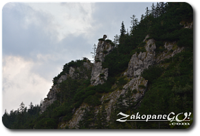
 Sarnia Skala
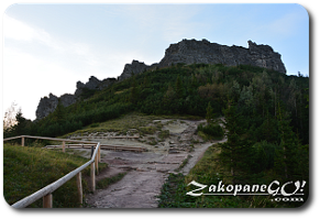
From the top, we have stunning views of the mighty proximate northern wall of Giewont and Zakopane looking in the opposite direction. This area was once heavily dug up by treasure hunters and their marks remain etched out in the rocks to this day. We return to the Czerwona Przełęcz (Red Pass), which owes its name to the iron ore in the soil, which causes its characteristic rust-colored hue. A half hour trek through the Sarni Żleb (Roe-deer Couloir) is next, after which we can return to Zakopane along the red trail between Dolina Strążyska (Strazyska Valley) and Giewont.
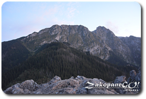 Giewont from Sarnia Skala
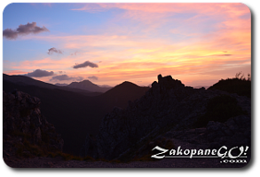 View from Sarnia Skala
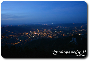 View of Zakopane