Dolina Białego (White Creek Valley)
![]()
Difficulty Level: *
Walking Time: 1h 15′ (2,5 km)
![]() 320m (1050ft)
320m (1050ft)
![]() 28m (92ft)
28m (92ft)
Climbing Features – NO
Highest Point: Polana Białego – 1212m (3976ft) a. s. l.
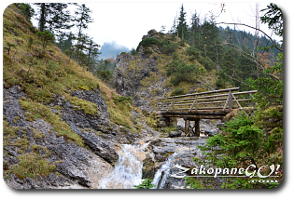
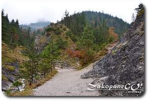
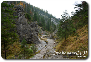
Dolina Białego (White Creek Valley) has a length of 2.5 km and an area of 300 hectares, situated between the massifs Krokiew (1378m) Sarnia Skala (Roe-deer Rock – 1377m) and Spaleniec ridge. It is an extremely pleasant trekking route. Beautiful and rich vegetation, water cascades and rock formations to be admired.
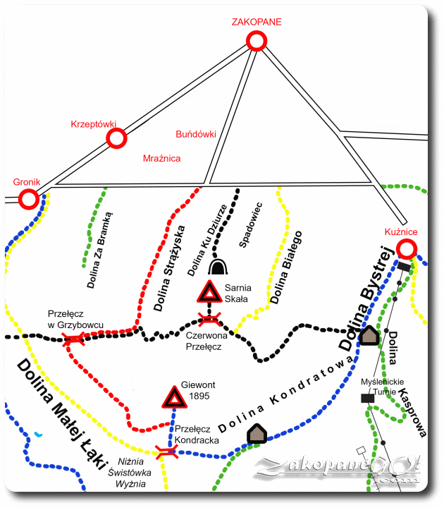
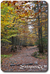
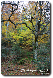
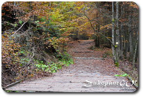
Dolina Białego (White Creek Valley) has a length of 2.5 km and an area of 300 hectares, situated between the massifs Krokiew (1378m) Sarnia Skala (Roe-deer Rock – 1377m) and Spaleniec ridge. It is an extremely pleasant trekking route. Beautiful and rich vegetation, water cascades and rock formations to be admired. Carved out in sedimentary rocks, mainly limestones and dolomites. Entrance to the White Creek Valley is located approximately half a mile west of the ski jump “Wielka Krokiew”, from which you can reach the mouth of the valley following Droga pod Reglami. A yellow hiking trail leads us deeper into the valley, though a forest made up of mostly fir and beech trees. In 1954, the national park established a strict nature reserve here.
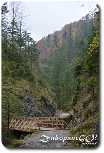
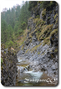
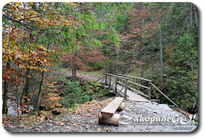
You may come across bird species, such as capercaillie and black grouse, which are protected. The trail runs along the Biały Potok (White Creek), which we follow up, crossing a number of wooden bridges, and going by numerous waterfalls and rapids.A few hundred meters from the mouth of the valley, we pass a barricaded entrance to a disused tunnel. Shortly after World War II, the Soviet forces tried to search this particular region for uranium ore in an attempt to construct an atomic bomb. Almost 300 meters of corridors were dug, the valley was closed to tourists, and the surrounding mountains and passes were surrounded by their army for several years.
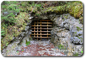
It is not known exactly when uranium mining stopped in the area. It is said that it took as long as eight years after the end of World War II to reopen the valley. There are no documents confirming this or otherwise. The route gently rises and after passing one of the waterfalls, the trail turns sharply to the left and steep zigzags lead to an almost completely overgrown Polana Białego (Bialego Glade). It connects to trail called “Ścieżka Nad Reglami”. You can continue your journey towards Dolina Strążyska (Strazyska Valley) or turn back and return to Zakopane heading down the same route.