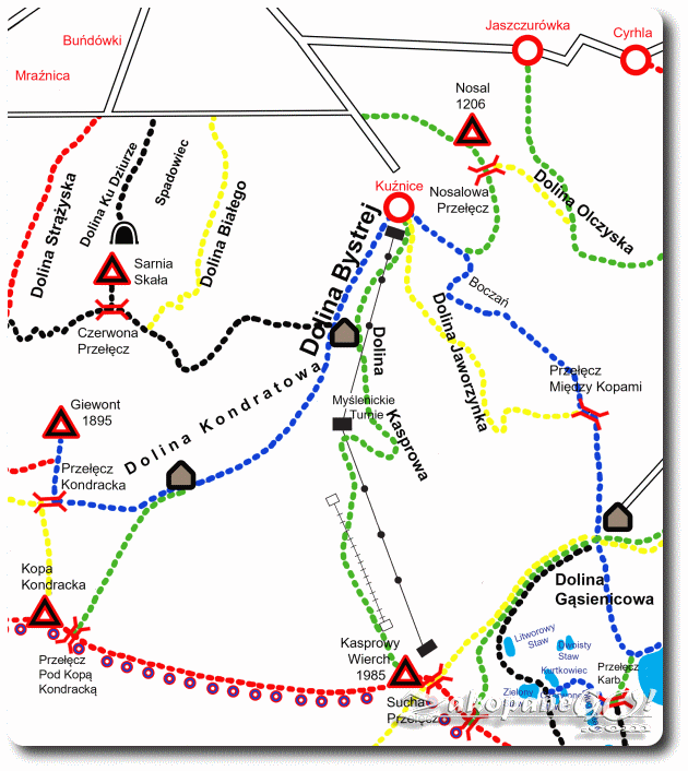
Kuznice – Kasprowy Wierch
![]()
Difficulty Level: *
Walking Time: 3h 15′ (6,3 km)
![]() 975m (3199ft)
975m (3199ft)
![]() 37m (121ft)
37m (121ft)
Climbing Features – NO
Highest Point: Kasprowy Wierch – 1987m (6519ft) a. s. l
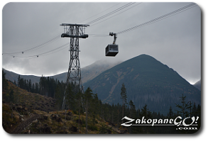
We follow the green trail, which initially runs through the Bystra Valley through the forest, until we reach Kasprowy, under the cable car and onto Dolina Kasprowa (Kasprowa Valley). Moments later, we pass a fairly wide Polana Kasprowa (Kasprowa Glade – on the left).
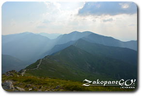
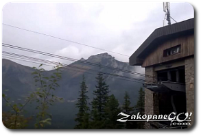
After about an hour from Kuznice (the route turns hard to the right) we get to Myslenickie Turnie, where the intermediate cable car station is situated. After leaving Myslenickie Turnie we begin a fairly tiresome approach. For about half an hour we wander through the forest, which ends just before the Sucha Czuba crest.We then zigzag along a stone pavement among the mountain pines. After bypassing this very large rocky hill, it is worthwhile having a look to the right – towards Dolina Kondratowa (Kondratowa Valley), Goryczkowa Czuba and Giewont.
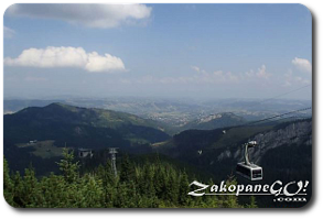
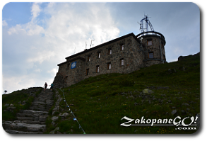
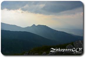
A fairly steep but not overly difficult approach comes next. After half an hour of leaving Myslenickie Turnie we summit Kasprowy Wierch. There is a meteorological observatory built on the peak and, slightly below it, the upper station of the cable car and chairlift from Dolina Gąsienicowa (Gasienicowa Valley). From Kasprowy Wierch, you can continue to trek the ridge towards Czerwone Wierchy (Red Summits) to the west or east toward Swinica, which stands at approximately 2,300 meters above sea level.