Hala Kondratowa – Przełęcz Pod Kopą Kondracką (Pod Kopa Kondracka Pass)
![]()
Difficulty Level: *
Walking Time: 1h 30′ (2,2 km)
![]() 530m (1739ft)
530m (1739ft)
![]() 5m (16ft)
5m (16ft)
Climbing Features – NO
Highest Point: Pod Kopa Kondracka Pass – 1863m (6112ft) a. s. l
At the shelter, turn left along the green trail. The path leads to a long stretch along the Polana Kondratowa (Kondratowa Glade), which is situated at the bottom of the valley of the same name. By entering between the dwarf mountain pine at the end of the clearing, the trail begins to climb gently.
With time, the steepness increases and the upper parts, under the pass, the path zigzags continuously . All the way through the southern approach, gently sloping face of Giewont is visible which strongly differs from the vertical northern cliffs, visible from Zakopane. After a little more than an hour of leaving the shelter we reach the pass. The green trail ends here, crossing the red trail which runs along the Polish-Slovak border.
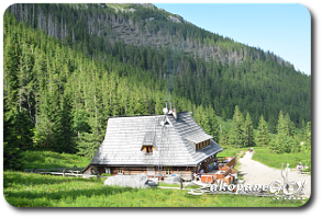 Kondratowa Shelter
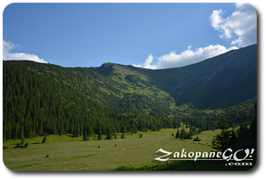 View of pass
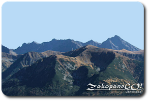 View from pass