Polana Zahradziska (Zahradziska Glade) – Ciemniak
![]()
Difficulty Level: *
Walking Time: 4h 05′ (5,1 km)
![]() 1113m (3652ft)
1113m (3652ft)
![]() 7m (23ft)
7m (23ft)
Climbing Features – NO
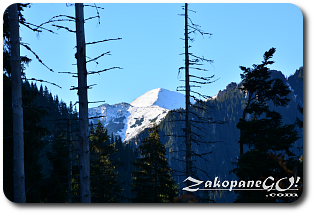
Highest Point: Ciemniak – 2096m (6877ft) a. s. l
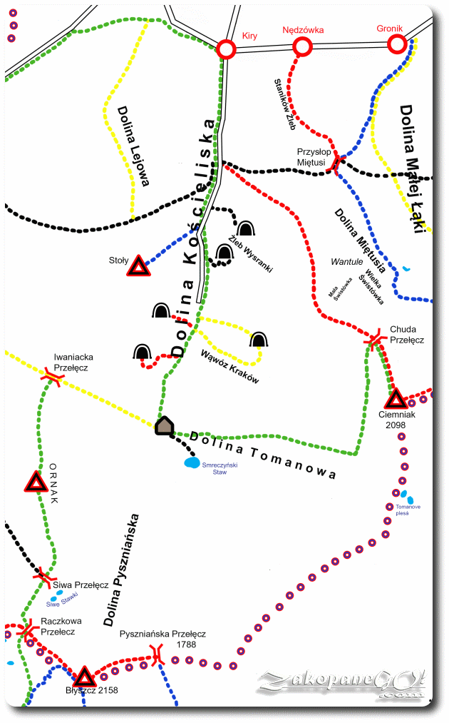
The red marked path to Ciemniak starts in the Dolina Kościeliska (Koscieliska Valley) at the first bridge over Kościeliski Potok (Koscieliski Brook), just after the extensive clearing called Wyżnia Kira Miętusia, situated around 10 minutes from the entrance to the valley in Kiry.
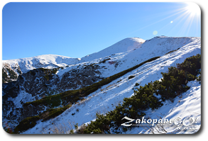
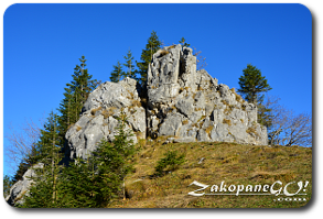
From the main road, a black trail to Przyslop Mietusi Pass and red onto Ciemniak, peel off to the left. The red trail runs parallel with the black trail, then turns right into the forest. A fairly steep path ascends the wooded ridge of Adamica. After an hour of strenuous approach, we cross the Polana Upłaz (Uplaz Glade), from which Kominiarski Wierch (1829m a.s.l.) is clearly visible. After another, much shorter, forest section, we walk out onto an exposed and much more scenic area with a perfect view of the western face of Giewont (1894 m), followed by an open ridge and bypassing a characteristic rock formation called Piec (Furnace – 1460 m).
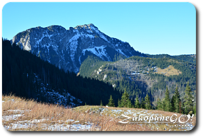
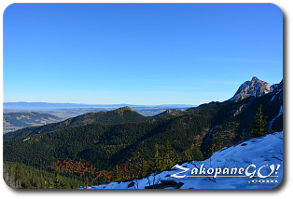
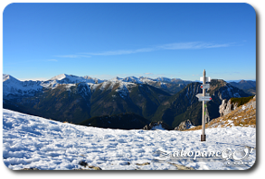
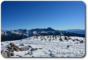
Further on, the road leads us uphill, among the mountain pines. In the bottom left you will see the post-glacial cauldrons Wielka and Mała Swistówka, lying at the foot of the limestone cliffs of the northern part of the Czerwone Wierchy (Red Summits). On Chuda Przełecz (Thin Pass), our trail connects to the green trail that runs through the Dolina Tomanowa (Tomanowa Valley) and the joint trail traverses the slope of Twardy Uplaz. On the left side, we have magnificent views of the rocky cliffs of Krzesanica. From the top of Ciemniak, the trek offers a beautiful panorama of Polish and Slovak Western and the Podhale region.