KOSCIELISKA VALLEY – CAVES
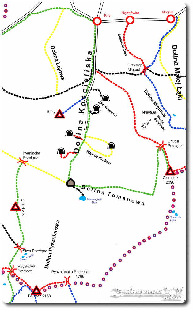
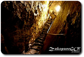
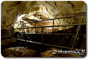
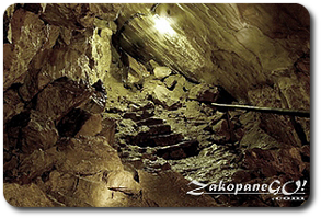
Mrozna Cave
Difficulty Level: *
Walking Time: 1h 25′ (1,4 km)
Length of cave: 500m (1640ft)
![]() 208m (682ft)
208m (682ft)
![]() 183m (600ft)
183m (600ft)
Climbing Features – NO
Highest Point: 1112m (3648ft) a. s. l
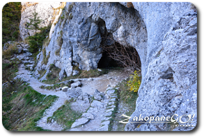
The approach to Jaskinia Mroźna (Mrozna Cave) begins at the outlet on Dolina Kościliska (Koscieliska Valley) just before narrowing valley called Brama Kraszewskiego (Kraszewski Gate). The entrance is situated in the Organy massif and can be reached by trekking along a forest path for around 20 minutes. The cave is open to visitors from early May to late October from 9.00 – 17.00. Admission to the cave is charged extra on top of the fee for entering the national park.
The cave has only one, almost horizontal corridor stretching the entire length (approx. 500 m) which is lit up and the walk through takes about half an hour. 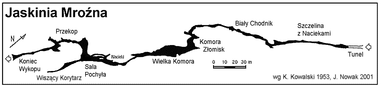
The name of the cave is derived from the constant temperature of 6 degrees Celsius, throughout the year. The descent back to Koscieliska Valley takes about 15 minutes, leading down very steep steps to the Polana Pisana (Pisana Glade).
Krakow Ravine & Smocza Jama Cave
![]()
Difficulty Level: **
Walking Time: 1h
Length of cave: 44m (144ft)
Elevation: 70m (230ft)
Climbing Features – Metal chain & ladder
Highest Point: 1118m (3668ft) a. s. l
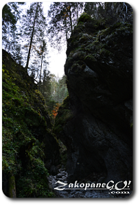
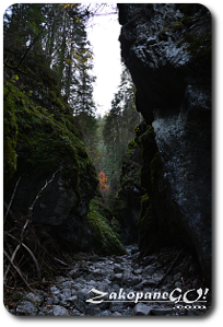
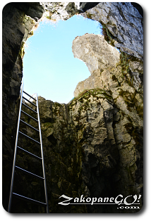
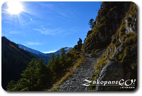
The entry point to the Krakow Ravine, which is the eastern arm of Koscieliska Valley, is located just behind the Polana Pisana (Pisana Glade). A forest path soon passes into the dark scenery of the rock walls surrounding the narrow gorge. Rising above the steep gorge are limestone walls which resemble the old town houses in the former Polish capital of Krakow, hence the name of this place. After fifteen-minutes, crossing the narrow bottom of the gorge, we are led to a steel ladder, which is the beginning of the steep approach into the Smocza Jama “Dragon’s Lair”.
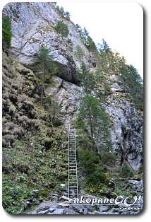
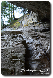
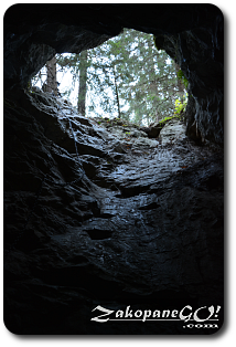
The rest of the ravine, running towards the south-east at the summit Ciemniak, is not open to tourists and is a strict nature reserve.The “Dragon’s Lair” is a single and short (44-meter), but steep corridor that pierces right through the rock in Ratusz peak. To navigate the cave you need a flashlight. A steel ladder, and then a short string of chains, run from the bottom of the gorge to the lower opening of the cave, and the crossing only takes a few minutes. You can bypass the cave by following a variant of the trail, which is steep path leading around and also features a set of chain supports. The descent back to Dolina Kościeliska (Koscieliska Valley) is, again, a one way system, which leads us under the Ratusz and Saturn peaks down to Polana Pisana (Pisana Glade).
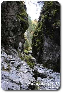
Raptawicka & Mylna Caves
![]()
![]()
Difficulty Level: **
Walking Time: 1h 30′ (1 km)
Length of Mylna cave: 300m (984ft)
![]() 179m (587ft)
179m (587ft)
![]() 115m (377ft)
115m (377ft)
Climbing Features – Metal chain & ladder
Highest Point: 1146m (3760ft) a. s. l
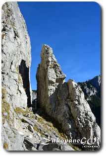
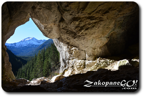
We begin the journey with a set of stone steps which lead us to a steep chute which we navigate, aided by sets of metal chains. After 10 minutes of climbing, the trails split up. The red trail continues horizontally under the rocks to Mylna Cave and black leads to Raptawicka Cave, turning sharply to the right directly onto a steep slope. Path leads us against the wall Raptawickie Turnie, where the entrance to the Raptawicka Cave is situated. Next, we climb the jagged rocks aided by the chains attached to them. At this point we are about 180 m above the bottom of Koscieliska Valley, on the narrow verge leading vertically to the bottom of the cave, which is located 4 m below. We go down a steel ladder into the hole which has a height of about 15 m, full of rocks which chipped off the ceiling and walls carved out by process of erosion. On the right, 30 metres long corridoor with a dead end. On the left, a similar corridor with a length of 20 m and a low ceiling.
Back up, we rejoin the path leading to the Mylna Cave following the same trail. Traverse following the red signs towards the opening of the cave. It is good to bring spare clothing, because in some sections you may need to crawl. The total length of the corridors in Mylna Cave is estimated at 1630 m, of which the labeled section is less than 300 m in length. It has a complex system of corridors and you can easily get lost in it. A torch here proves to be an essential piece of kit! Within these tight and extremely low corridors, wearing a helmet is also important. Entering alone is not advised! There has been one fatal accident in the underground labyrinths of Mylna Cave recorded in 1945. Two weeks of search and rescue action brought no effect and the body was eventually found two years later in a remote corridor. It was established that the tourist went astray due to loss of light, and consequently the cause of death was starvation. Dead ends in the cave are marked with red triangles. Exploring the accessible part of the cave takes around half an hour and finishes at the outlet which brings us out onto the red trail and back down to Koscieliska Valley.