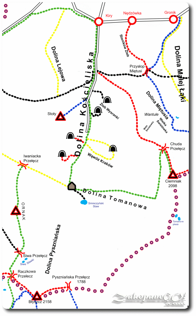
Koscieliska Valley – Tomanowa Valley – Ciemniak
![]()
Difficulty Level: **
Walking Time: 3h 35′ (6,5 km)
![]() 1025m (3363ft)
1025m (3363ft)
![]() 71m (233ft)
71m (233ft)
Climbing Features – NO
Highest Point: Ciemniak – 2096m (6877ft) a. s. l
A scenic, but not very popular, rarely chosen route to the Czerwone Wierchy (Red Summits). It is usually peaceful and quiet down in the valley. We depart from Hala Ornak following a green trail. For a little over half an hour we tread a pleasant forest path along Tomanowy Brook. Soon we get to Niznia-, and a moment later Wyznia Tomanowa Polana (Glade) which is a very picturesque place, with a beautifully presented Tomanowy Wierch Polski. Twenty minutes later, the trail turns left and we walk for a few minutes along another forest path before a heavy approach.
We leave the forest and the path becomes extremely narrow with wooden footbridges in certain places.We cross through the Czerwony Zleb (Red Couloir – name due to the characteristic colour), where you have to be careful, especially in the rain, when passing near the precipice (inexperienced tourists may feel some anxiety creeping in).
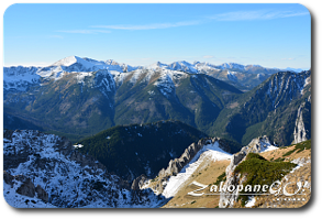
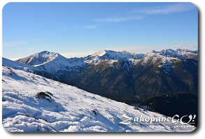
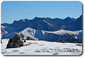
The road continues steeply up some stone steps, and then a tough rocky path. Trekking through Niski Uplaz, you pass some beautiful rock formations – Tomanowe Rzędy – which form the western slopes of Ciemniak. Navigating stone slabs we reach the Wysoki Grzbiet (High Ridge), with the left side of us enriched by more and more magnificent panoramic views. After another few minutes we reach Chuda Przełęcz (Thin Pass) and walking concurrently along the red trail for about half an hour we reach the summit of Ciemniak.