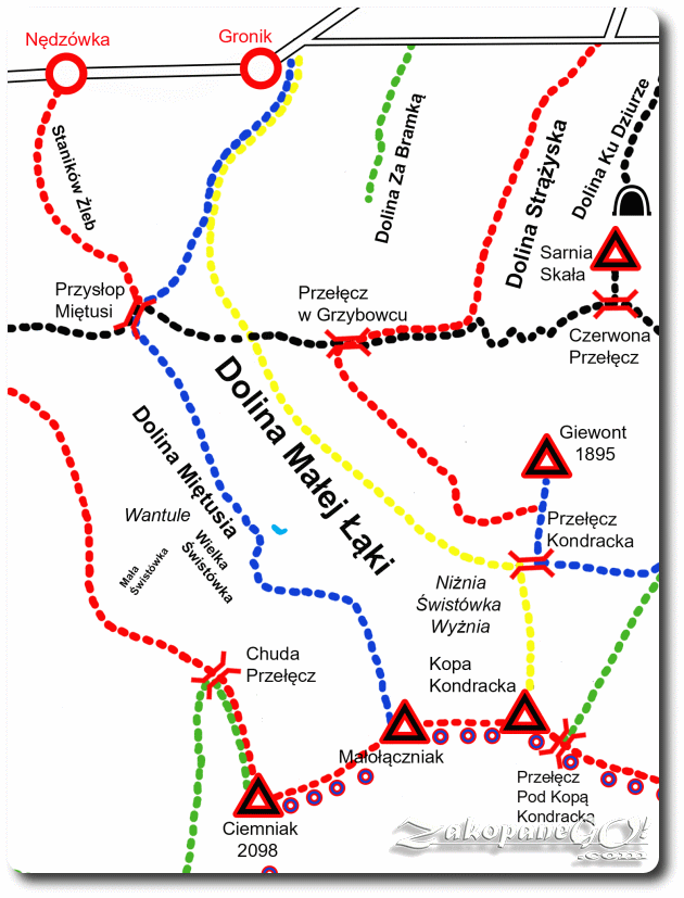
Gronik – Przyslop Mietusi Pass – Malolaczniak
![]()
Difficulty Level: **
Walking Time: 3h 55′ (6,4 km)
![]() 1177m (3861ft)
1177m (3861ft)
![]() 47m (154ft)
47m (154ft)
Climbing Features – Metal chains
Highest Point: Malolaczniak – 2096m (6877ft) a. s. l
The most attractive and also the least crowded of all routes leading to Czerwone Wierchy (Red Summits). Only the section leading through the Kobylarzowy Couloir can present us with any problems. From the mouth of the Dolina Małej Łąki (Little Meadow Valley), a blue trail leads onto Przyslop Mietusi Pass, initially running along the yellow trail to the Przełęcz Kondracka (Kondracka Pass).
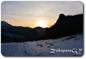
After about 25 minutes, the blue trail turns right, steeply uphill along a forest road. The broad and scenic saddle of the pass is reached after 45 minutes, counting from the mouth of the Dolina Małej Łąki (Little Meadow Valley). We pass another intersection crossing the black trail as well as the red trail towards Nedzowka. From Przyslop Mietusi Pass we have an interesting panorama of the surrounding Dolina Miętusia (Mietusia Valley), Czerwone Wierchy (Red Summits) and cliffs plunging into Wielka Swistowka, a view of Kominiarski Wierch and Zadnia Kopka to the west, and in the foreground we have the soaring Zawiesista Turnia.
From the intersection of routes on Przyslop Mietusi Pass, blue signs to Malolaczniak lead towards the south. Initially, the trail leads almost horizontally down a comfortable, narrow lane. Occasionally through the forest we can pause for good views of the valley, Prog Mulowy, Twarda Galeria and Kazalnica Mietusia.
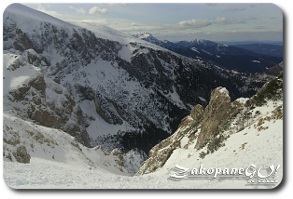
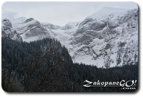
The remainder of the path is far steeper and after about 30 minutes the trail leads through a gully called Wodnisciak. The path leads out of the forest onto a grassy plateau Kobylarz (1430m). Kobylarz is a good vantage point, exposing the rocky and rugged surroundings.The road takes on a truly alpine character. The trail turns to the east and enters the Kobylarzowy Żleb (Kobylarzowy Couloir).
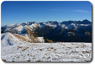
The path climbs steeply through the bottom of the gully, surrounded on both sides with spectacular rock walls. The approach features a rock wall, which we overcome by navigating a set of chains, after which the trail brings us out onto a grassy slope. The road is still steep and tiring. After less than 2 hours from Przyslop, the trail reaches Czerwony Grzbiet (Red Ridge) which stems from the top of Malolaczniak. From the ridge we have another very interesting view of Giewont.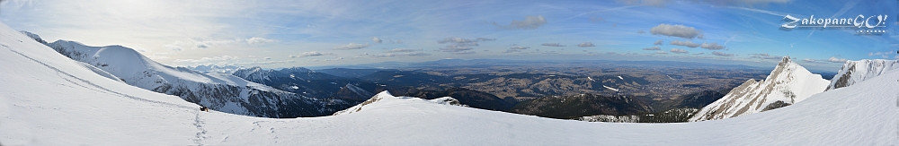
In the opposite direction, the panorama includes Kominiarski Wierch and from Ciemniak, a ridge featuring Twarda Kopa, Chuda Turnia and Uplazianska Kopa. Equally nicely presented here, is the entire Podhale region.
Onwards, the trail leads along a panoramic and grassy Czerwony Grzbiet (Red Ridge) and eventually we reach Malolaczniak after overcoming a few more hilltops. The approach takes about 40 minutes. Lying in the middle of the Czerwone Wierchy (Red Summits), Malolaczniak is a splendid vantage point.
The panorama from Malolaczniak is without a doubt one of the richest in the whole of the Tatra Mountains and includes both the Western Tatras with Giewont and Kasprowy Wierch, as well as the High Tatras with Gerlach, Rysy, Swinica and Krywan. Beautifully presented here are, located more than 1,000 meters below, Zakopane and the entire Podhale region. A red trail runs through the top, leading west towards Krzesanica and Ciemniak or east towards Kopa Kondracka; the smallest of the Czerwone Wierchy.