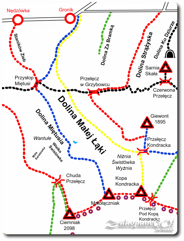
Dolina Małej Łaki (Little Meadow Valley) – Main Ridge
![]()
Difficulty Level: *
Walking Time: 1h 30′ (3,0 km)
![]() 193m (633ft)
193m (633ft)
![]() 412m (1352ft)
412m (1352ft)
Climbing Features – NO
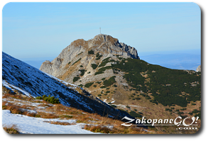
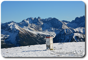
Highest Point: Krzesanica – 2122m (6962ft) a. s. l
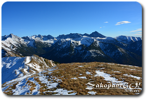
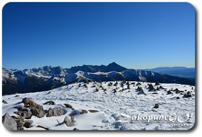
With the entire length of the ridge and Czerwone Wierchy (Red Summit) exposed from either side, the area offers extensive views. The peaks and ridges are relatively easily accessible and tourists do not encounter any problems in the summer. They are grassy, gentle and rounded. The Wierchy are treacherous in the winter and when there is fog however, as it may cause loss of orientation and increases the risk of getting lost or an accident.
In the area of Czerwone Wierchy there have been many instances of tourists and even experienced mountaineers going off-trail, which often ended in tragedy. The name of the hills comes from the reddish-brown color of their slopes, caused by an array of plants known as highland rush, which in autumn, and often already in mid-summer, turn red. Leading mainly along the ridge, this trail is one of the most interesting scenic routes in the area. Our journey starts at the Przełęcz Pod Kopą Kondracką (Under Kopa Kondracka Pass), the easternmost of the peaks and reached in around half an hour along a simple but very steep path.
From Kopa Kondracka there is an option of a yellow trail onto Przełęcz Kondracka (Kondracka Pass). A grassy and rounded summit of the Kopa Kondracka is a great place to stop. Heading to the west, we descend significantly onto Małołącka Przełęcz (Malolacka Pass). From here, we have another tedious climb onto Malolaczniak (2096) from which there is another option, this time north bound along a trail leading onto Przyslop Mietusi Pass.
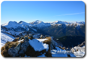
We cross the Litworowa Przełęcz (Litworowa Pass) and after a short approach along the ridge, with a steep cliff on our right, we reach the highest of the Czerwone Wierchy – Krzesanica (2122 m). This section of the trail can seem a bit dangerous due to the proximity of the cliff edge. The last point on this small mountain range is Ciemniak, from which we can descend to Dolina Kościeliska (Koscieliska Valley) following either the red or green trail correspindingly.